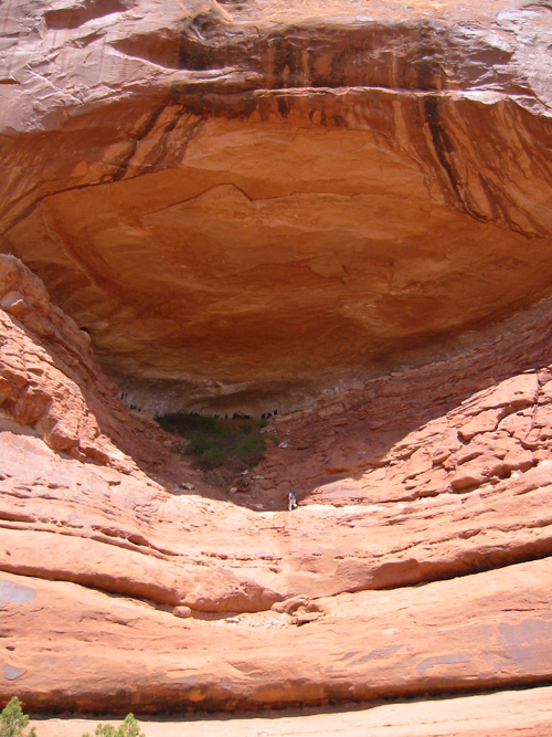
Image of groundwater sapping. John for scale (just below vegetation mass in image above). Image above shows "zoomed in" section of alcove on left in image below.
NAVIGATION: BACK TO MODULE TWO INTRODUCTION
Groundwater Sapping Features
Image of groundwater sapping. John for scale
(just below vegetation mass in image above). Image above shows
"zoomed in" section of alcove on left in image below.
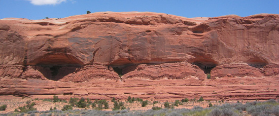
A series of groundwater sapping "alcoves"
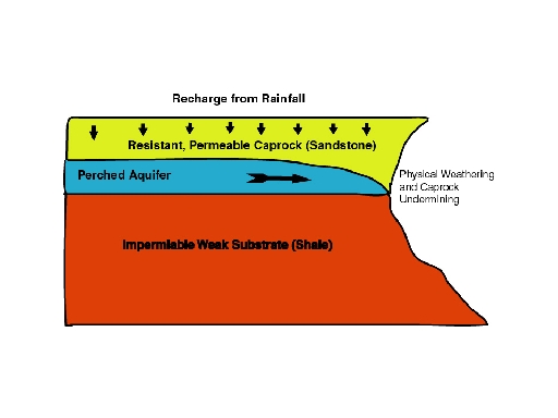
As a result of recharge from precipitation (adding water via precipitation), an aquifer forms in the sandstone on top of the relatively impermeable rock layer and weaker underlying strata. The infiltrating groundwater flows laterally (across) and exits at seeps at the edge of the scarp (as seen above; where blue area pinches off). These areas of concentrated moisture induce weathering of the sandstone at and along the seep area. Certain weathering processes (freeze-thaw, crystal growth of evaporative salts) are favored near the water's exit. The retreat of the scarp face causes undermining of the overlying sandstone, which falls into the alcove or to the valley floor below. Thus, the rounded alcoves are formed.
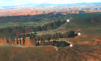
Oblique view of sapping features - asterisks
indicate "heads"
of the sapping valleys.
This (image above) is an oblique aerial view of sapping valleys working (weathering) headward deeper into a scarp. This area is capped with Navajo sandstone. Recharge (from precipitation) occurs on the flat upper surface of the sandstone. The white stars mark locations of headwalls with groundwater sapping (moisture sources). Image above and content for this caption and above diagram of sapping taken from here.
Want to learn more about sapping? Here are some links: