I. CHARACTERISTICS, THE HYDROLOGIC CYCLE, AND DISTRIBUTION
A. Characteristics
- liquid
 , solid
  , gas
, gas 
- expansion when freezes
- "universal solvent"
- surface tension (2nd video [:30])
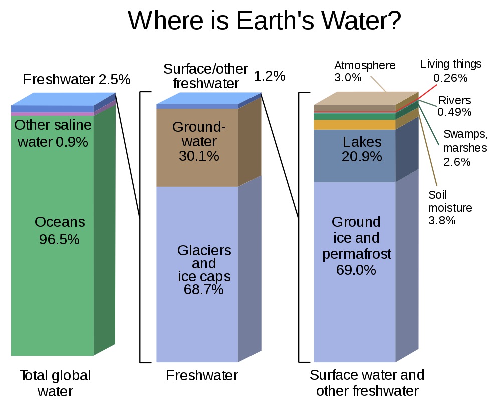
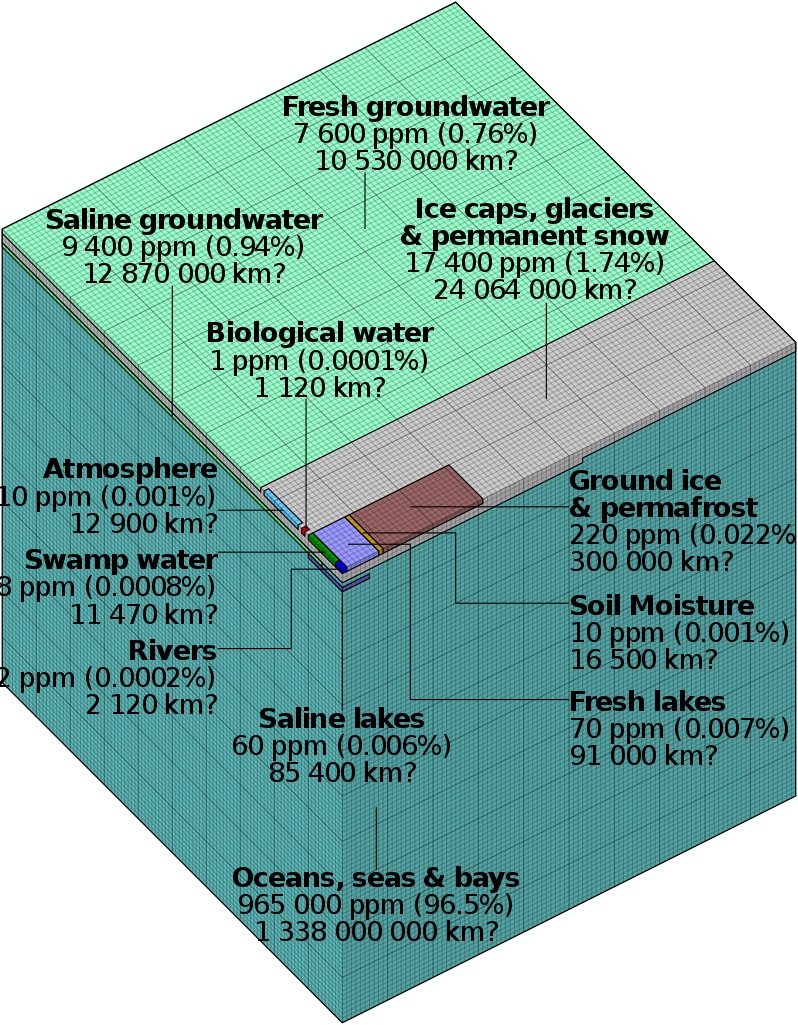
C. World Distribution of Water (another view)
residence times of water
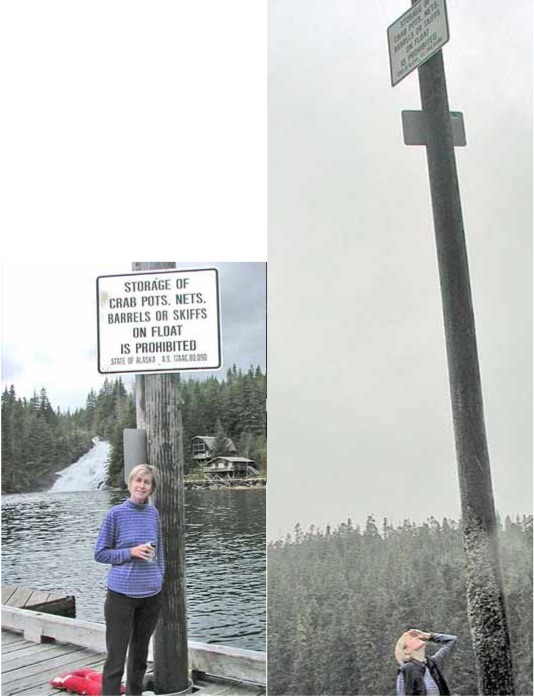
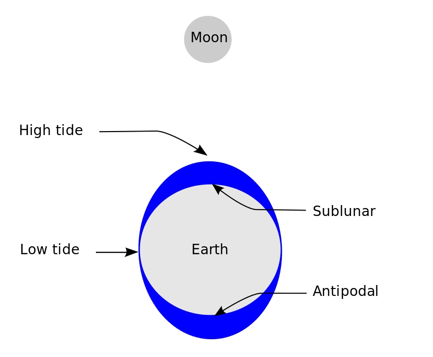
II. TIDES
A. Periodicity: High and Low Tides (or this one)
B. Gravity of Moon and Sun
C. Terminology
- spring tide vs. neap tide
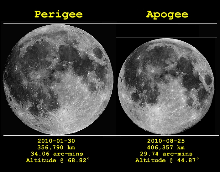
- perigee vs. apogee (lunar dist.) affects tides
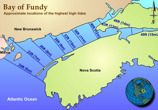
- tidal range
- small vs. large (Bay of Fundy)
- shape of bay
- tidal bore
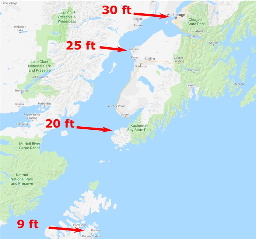
- smaller: France ; video from near Anchorage, AK
- larger: China ; video of the same area
- "The Silver Dragon", Qiantang River, China
- "Pororoca", Amazon River
A. Locations and Characteristics
B. Terminology
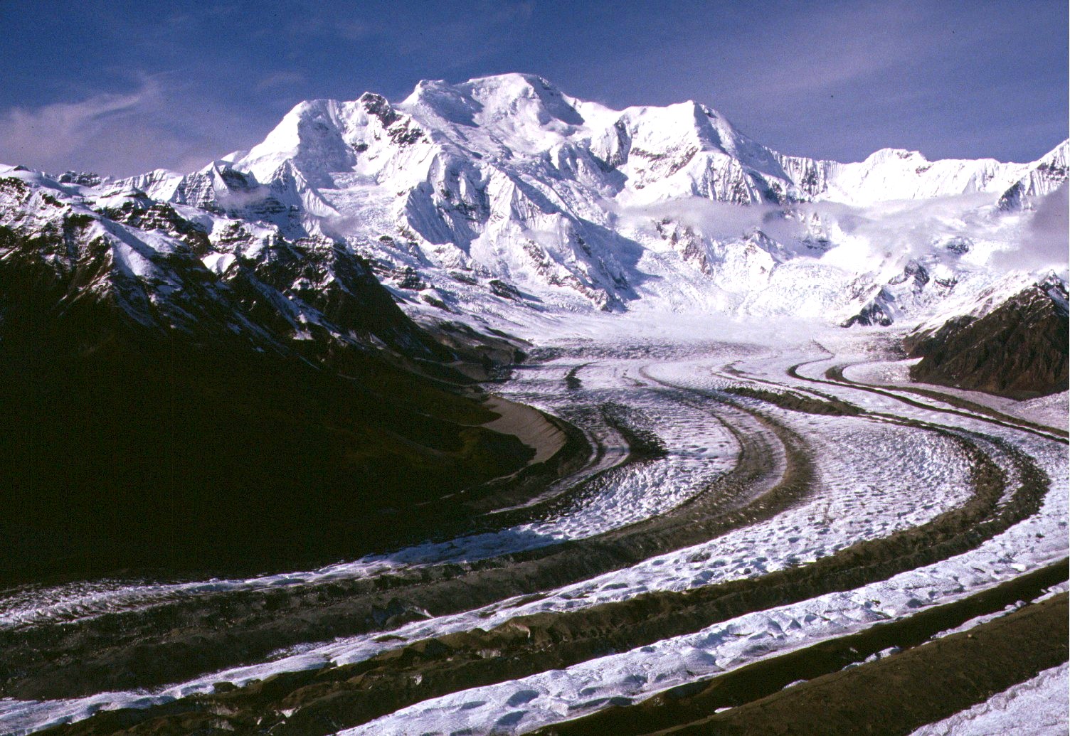
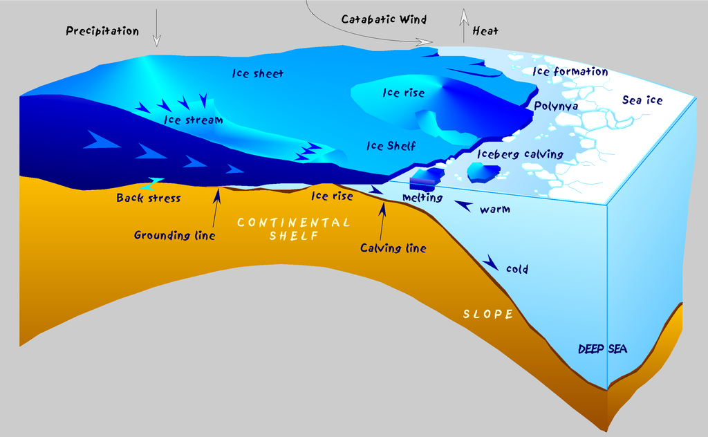
- glacier vs. ice sheet
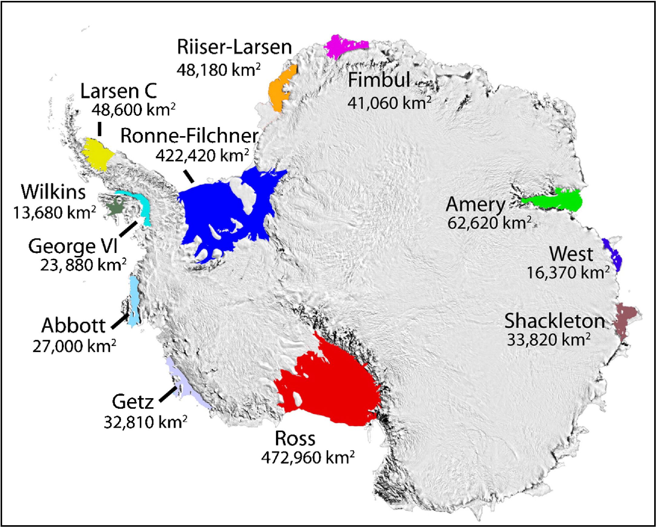
vs. ice shelf (satellite view ... close up ... map) - calving: iceberg (size) vs ice floe (ice floe2) (video 1) (video 2)
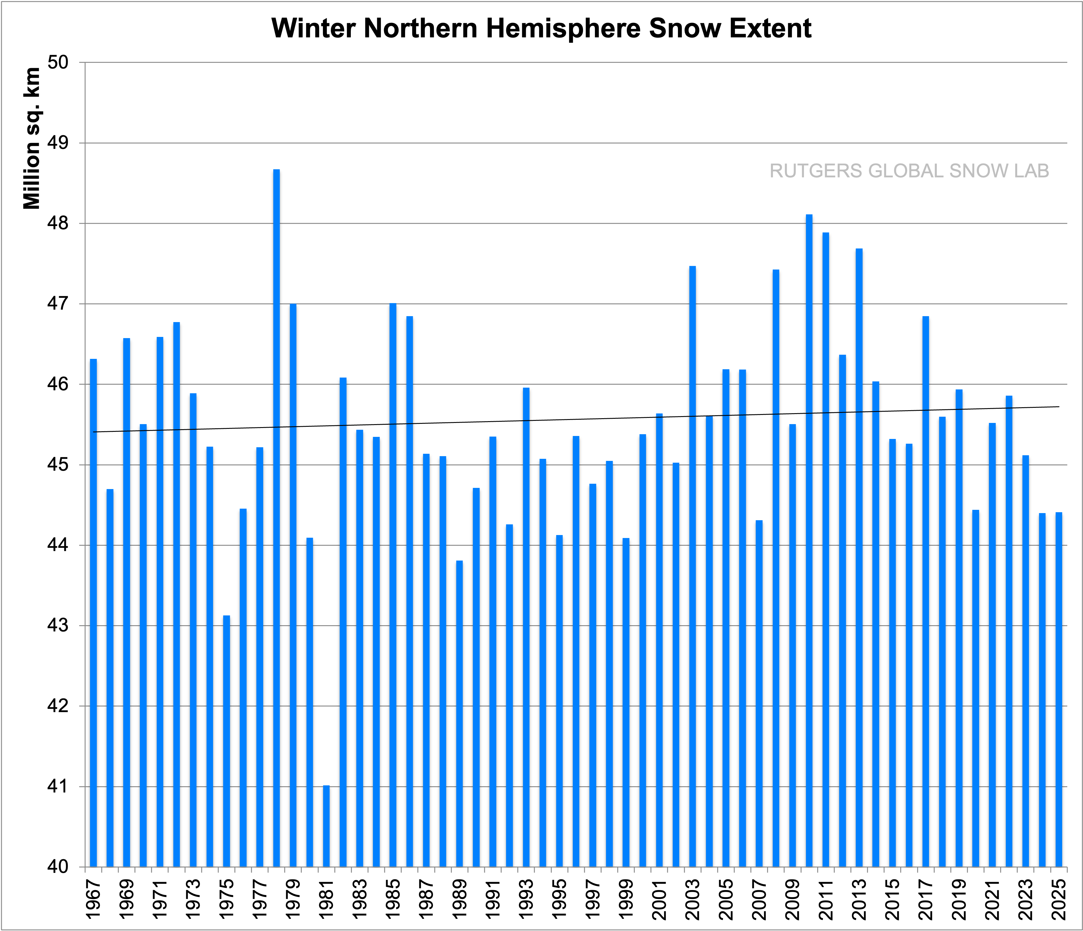
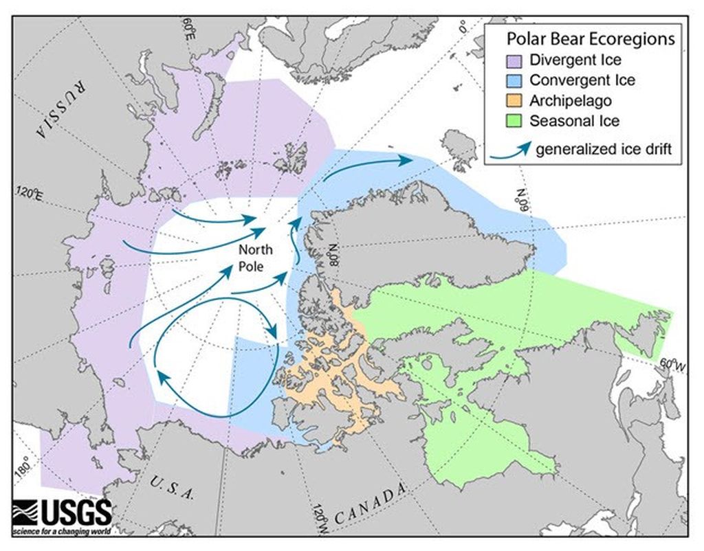
- polar ice melting away? Arctic vs. Antarctic (Less snow in the northern hemisphere?)
A. Lakes (ponds?) vs. Reservoirs
- What's in a name?
- Caspian Sea; Salton Sea
- Aral Sea... animated satellite view
- Amazon (at Manaus) (satellite view)
- Nile --- flooding: is it always bad?
- Aswan Dam, Egypt (satellite view)
- reservoir = 107M acre feet; 340 mi long
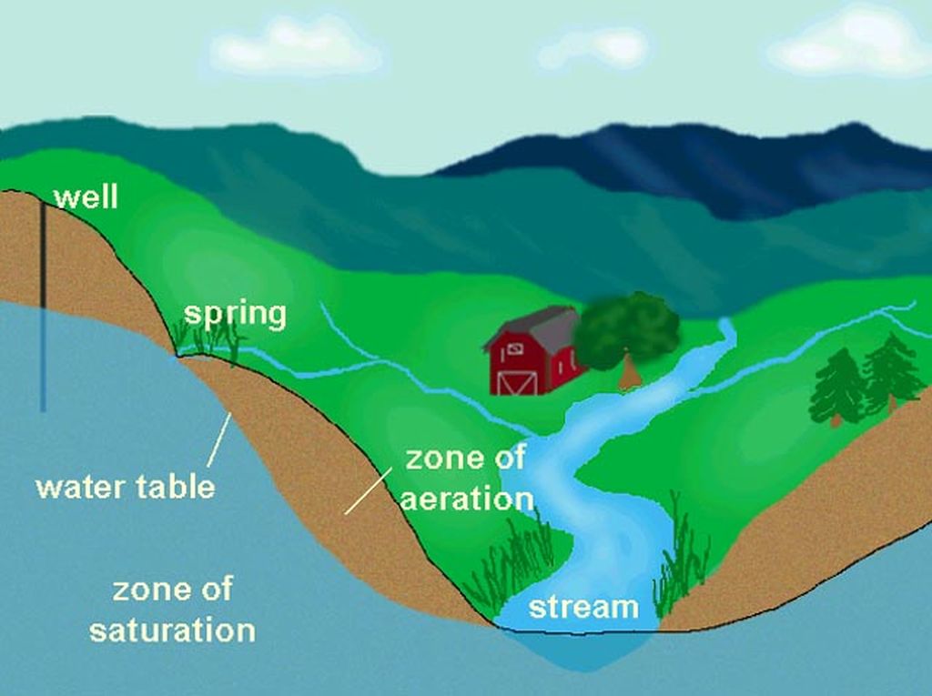
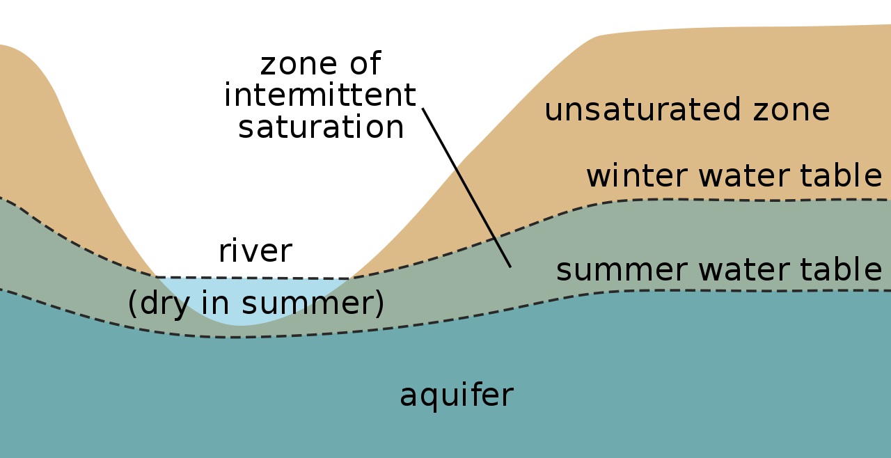
V. GROUNDWATER
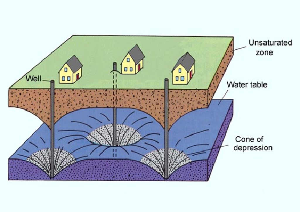
- zone of aeration -- soil moisture
- zone of saturation (a.k.a. aquifer)
- water table
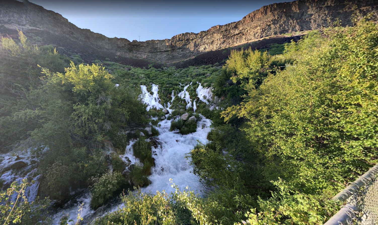
- springs (Niagara Springs, ID) (Horton Springs, AZ)
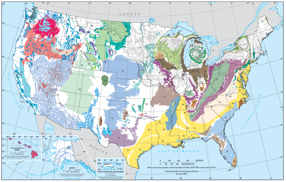
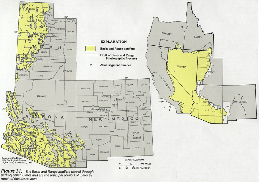
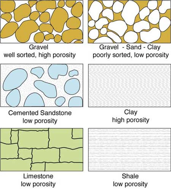
- type of aquifer: permeable material
- porous media: sand and gravel
- cracked or fractured rock aquifers
- flow, withdrawal, and recharge rates
- heavily used aquifers
- cone of depression (animation) (animation 2)
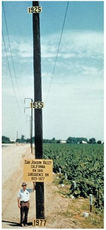
- subsidence (CA) (AZ map)
- subsidence cracks... photos:
- SE Valley 1 / 2 / 3 / 4 / a garbage dump?
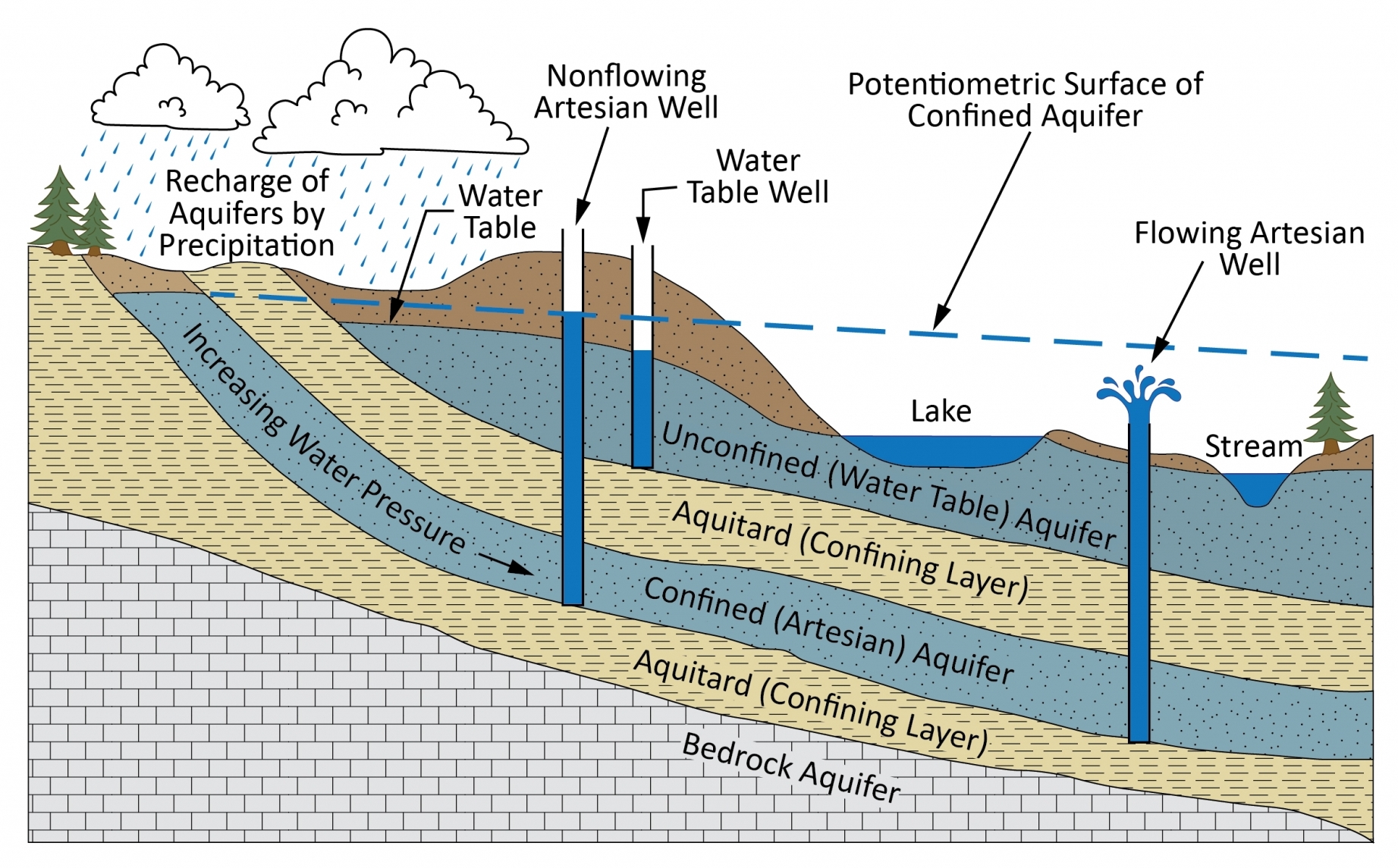
- confined aquifers (zone of confined water)
- artesian aquifers -- artesian wells
- water table & piezometric or pressure surface
- subartesian well
- artesian aquifers -- artesian wells
- stream feeding / discharging
- salt water intrusion
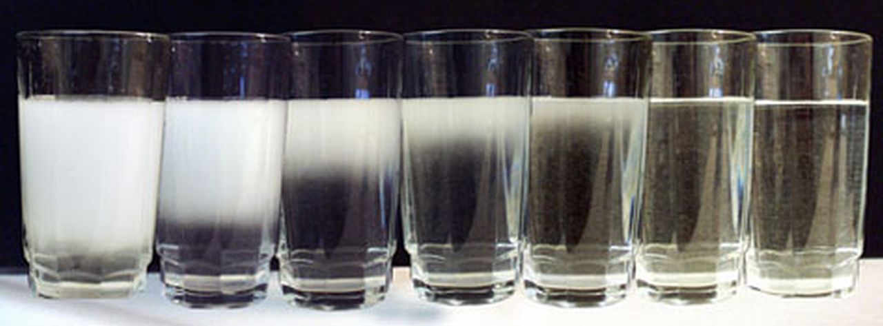
A. Water Purity
- Beware of false claims about water purity
- Beware of *loaded* words: "healthy", "safe", "natural", "chemicals", and many others...
- "raw water"?? "non-GMO water"??
- effluent
- Pure Water Phoenix Project (location) (proj flyer) (video)
- Nogales Intl Wastewater Treatment Plant
- 80% comes from Nogales, Sonora, MX
- A good thing we are treating Mexican sewage?
- Only 28% of AZ public supports use of effluent on edible crops
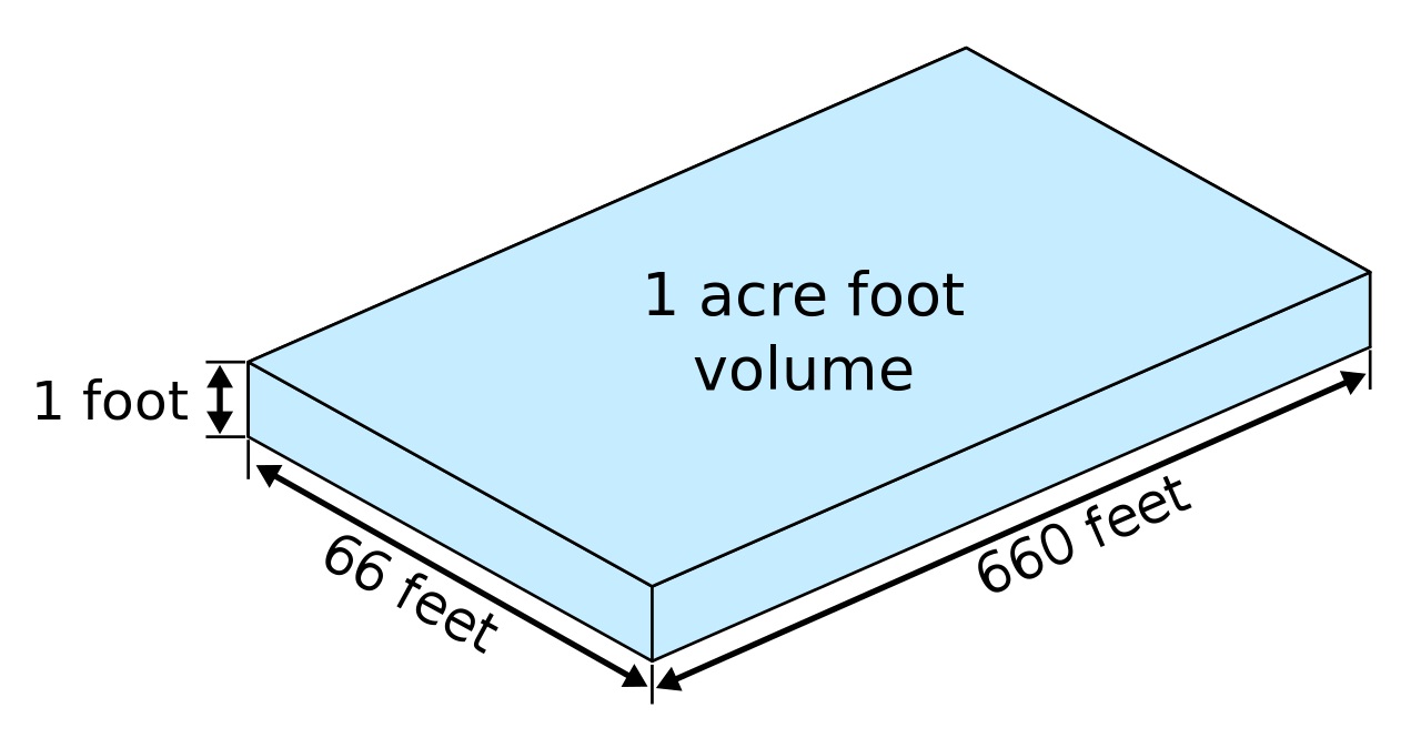
- Measurement
- acre foot = 1 acre, 1 foot deep
- = 325,000 gallons (approx. = 16 backyard swimming pools)
- = avg annual water used by family of 4-5 (**conservation?)
- Lake Mead - 1,075 ft. "crisis level"
- *1045 ft as of Jan 2023
- lowest level usually in July (1083' in 2019... 1081' in 2020... 1067' in 2021)
- Phoenix Metro Population
- 5 million... and growing
- save 1 gal/day per person = 4.6M gal/day
- in one year = 5100 familes worth of water
- if those 5100 families also conserve?
| CLIMATE / HYDROSPHERE CHAPTERS -----> | Climates | Hydrology |
| Next section -----------------------> | Biosphere |