NAVIGATION: BACK TO MODULE FIVE INTRODUCTION
Eddie McKee (1906-1984) and Stream
Piracy proposed 1964
McKee, the coolest geologist ever to study the Grand Canyon. Look at the pictures, the guy looks like Brad Pitt's brother in some old western movie. But he was no Hollywood pretty boy, but the real deal. A very talented geologist who fell in love the with the Grand Canyon. McKee is probably the most famous geologist to work on Grand Canyon's history, outside of Powell. McKee was the first Park Geologist for Grand Canyon National Park. Let me tell you a story about McKee. He once had a problem with dinosaur tracks in the Coconino Sandstone, the prominent white cliff near the top of the Grand Canyon. The Coconino Sandstone represents a huge sand dune deposit that covered much of western North America around 250 million years ago. He found that dinosaur tracks were preserved in the formation when critters ran up the steep face of a sand dune, but none preserved with the critters running down the sand dune. This was odd, either the critters never ran down the dunes, which definitely doesn't seem possible, or something else was going on. McKee solved the problem with a Chuckwalla, a very big lizard native to the region. He took his Chuckwalla over to some sand dunes east of Grand Canyon near the Little Colorado River. After a rain storm he turned his chuckwalla loose to see what happened. The big lizard ran all over the sand dunes, and McKee observed that every time the lizard ran up a sand dune, a great set of tracks were preserved, but when he ran down, the sand would cascadel right behind him and destroy any evidence of its passage. I think that story tells a lot about the kind of thinker McKee was.
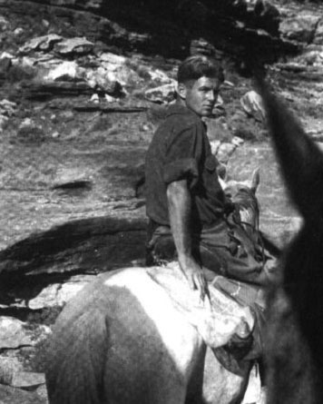
Figure 1. Images of McKee in his younger days visiting the Havasupai Reservation.
So here's the deal, you're Edward McKee, famous Grand Canyon geologist. It's the early 60s and you're commonly called in to give geology talks to special guests, like presidents and movie stars. You know his visitors had to be asking him, "How did the Grand Canyon form?". McKee probably went into some detail about the older ideas we just covered previously. But in the end, he had to admit that nobody really knew how Grand Canyon formed, not even him--the renowned expert. And well, I bet not too many renowned experts in anything could stand not knowing something as basic as how the thing you were supposed to know so much about formed in the first place. So McKee in 1964, not being any different, decided to get anybody who'd ever worked on Grand Canyon together for a conference at the Museum of Northern Arizona in Flagstaff to solve the problem.

Figure 2. An informative diagram illustrating the Ancestral Colorado River Drainage and Hualipai Drainage postulated at McKee's conference
They proposed stream piracy. The mechanism and catchy name was originally described by the famous geomorphologist William Morris Davis. To take care of the ever present "Muddy Creek" problem, they divided the development of the Colorado River into two parts. East of the Kaibab Plateau, the "old" Colorado River drained out of the Rockies and ponded in a lake represented by the Bidahochi Formation originally discovered by Newberry. While the Colorado River drained into this lake, another drainage developed on the west side of the Kaibab Plateau that McKee's group termed the "Hualipai Drainage". This drainage fed from the Kaibab Plateau and drained into the Lake Mead region. Due to the opening of the Gulf of California and hypothesized uplift of the Colorado Plateau, the Hualipai Drainage began to erode into its channel due to the drop in base level. The idea of base level was first recognized by Powell. A drop in base level gives the drainages excess energy and causes them to cut into their beds and reacquire a new base level and or equilibrium gradient. With the base level, the Hualipai Drainage eroded backward or headward into its headwaters via a set of knickpoints, a fancy word wateralls.
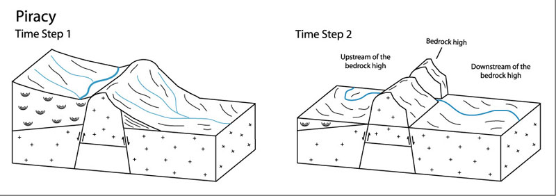
Figure 3. A simple diagram of piracy.
McKee and his group propose that the Hualipai Drainage eroded headward from the Lake Mead area, across the Kaibab Plateau, and captured the Colorado River. This switched the river's flow from draining into Lake Bidahochi to the route it takes today through the Grand Canyon. The Muddy Creek Formation would have deposited while the Hualipai Drainage was eroding headward. Only after Muddy Creek deposition did the Colorado River become captured and enter the Lake Mead region. The idea was published in The National Geographic magazine as the new explanation for Grand Canyon incision. Numerous scientists support the variations of this idea, but none of them are universally accepted.
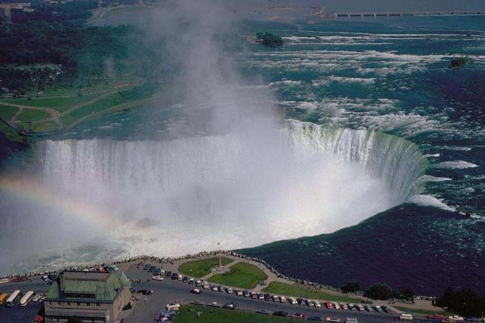
Figure 4. Knickpoints develop following a drop in base level and allow headward erosion. Which of these knickpoints do you think could develop near the rim of a drainage divide, like along the crest of the Kaibab Plateau?
One problem is the idea of a single drainage eroding headward from the Lake Mead region back to and across the Kaibab Plateau. If a base level drop affected the hypothesized Hualipai Drainage, all the drainages feeding into the Lake Mead region would have been affected. As a result, you should expect to see numerous drainages eroding long distances headward towards the Kaibab Plateau. But the Grand Canyon is just one big canyon, not made up of multiple interconnected canyons. Also, headward erosion only forces a drainage divide to retreat away from a drop in base level, but this is a time intensive process and still requries a drainge directly opposite of the drainage divide to spill across (the Colorado River in the case of the Grand Canyon). For these reasons and others, people are still searching for different answers to explain the development of the Grand Canyon.
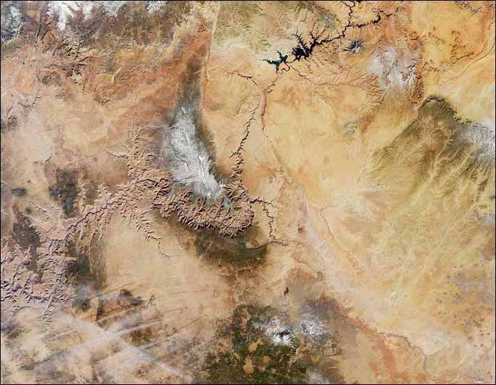
Figure 5. Grand Canyon is a single canyon, not made up of a bunch of canyons.