|
|
 |
| GPH 111 |
| Exercise 14 - TEMPE BUTTE |
|
|
|
|
|
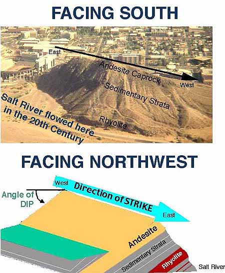
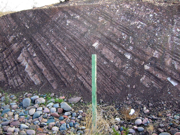
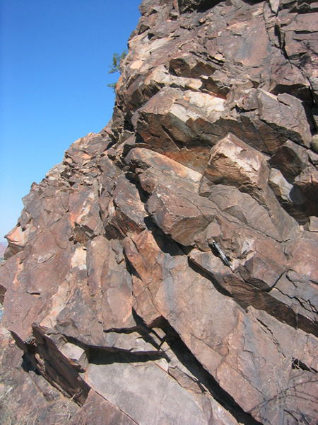
Principle of Superposition- There is a very simple, common-sense concept used in archaeology, geography, and geology: the lower sediments are older than the upper sediments in a deposit. At Tempe Butte, there are 3 general types of deposits. First came the volcanic ash (rhyolite rock type) that fell upon mudflats. Second came deposits from a sandy and muddy river. Last came the lava flow (andesite rock type). Then, after all of the deposits were laid down horizontally, they were tilted to the south.
|
|
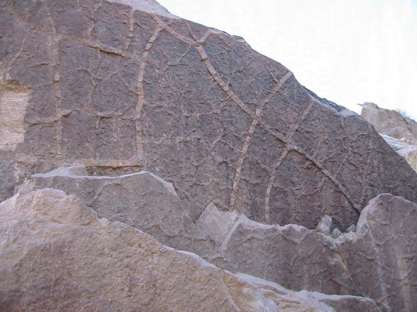
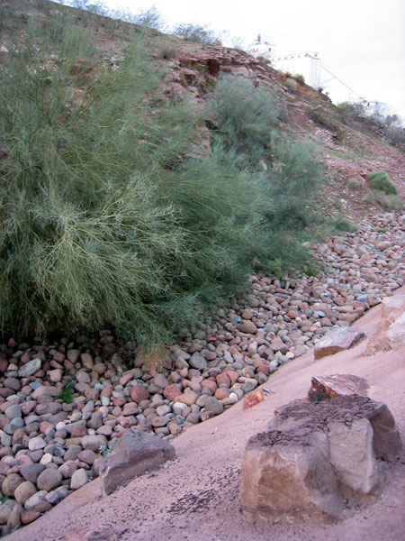
The North Side - A fundamental part of this lab compares the south side of Tempe Butte with the North Side of Tempe Butte. The two sides are very different. The questions in the lab manual try to get you to explain some of these differences. |
|
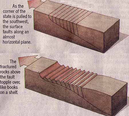
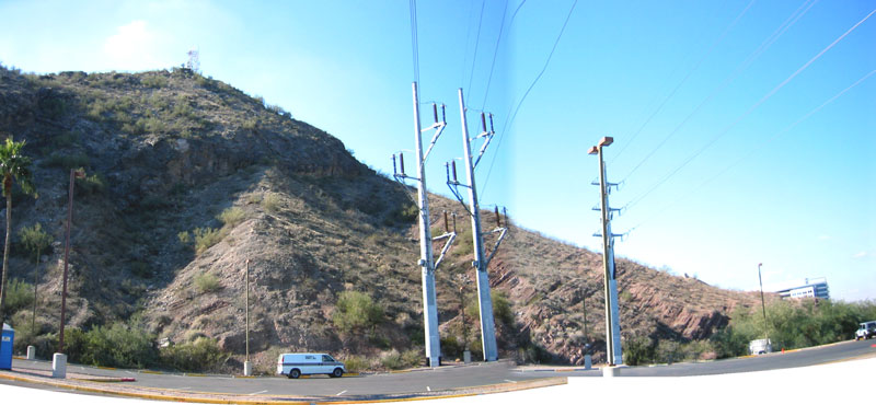
Geological History of Tempe Butte as it Relates to the Phoenix Area - This historical geology story of Tempe Butte starts with the San Andreas Fault when it was created in the Los Angeles area. Prior to the San Andreas Fault, Arizona and southern California experienced compression. The making of the San Andreas Fault meant that the compression stopped. As a consequence, southern Arizona started to stretch. Since the top of Earth's crust is brittle, streching southern Arizona created faulting that might have looked like these diagrams conceptualized by ASU Geology Professor Steve Reynolds:
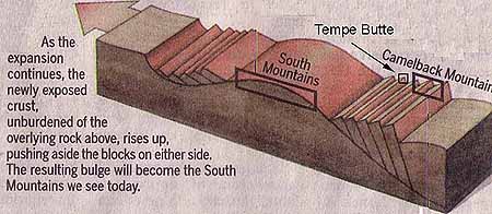
Tempe Butte would have been located inside one of the basins. The basin created a "trap" for all of the sediments you see. The deposits in the basin were laid down between about 25 million and 15 or so million years ago. First came the rhyolite underneath the Tempe Beds. Then came the Tempe Beds (flood deposits). Last came the andesite lava flow on top of the Tempe Beds. All of these deposits were laid down in a flat-lying position in a basin. The extension of southern Arizona did not stop, but it changed in character. When the crust was thinned, as in the diagram below, the rocks underneath flowed upwards. This process is called isostacy, and it produced the South Mountains (South Mountain Park) to the southwest of Tempe Butte. Tempe Butte was created as the South Mountains domed upwards, twisting and tilting the sediments into the position you see today.
Physical geography processes then act upon this "geological blackboard". The simple version of Tempe Butte's development is this: 1) First the Tempe Beds were laid down by west flowing streams (click here). 2) Periodically, ignimbrite eruptions from the Superstition Mountains inundated these streams with hot ash (click here). 3) An andesite flow from the south covered the ash laded Tempe Beds streams (click here). 4) The whole rock packaged was tilted as the Tempe Butte block rotated off of South Mountain (click here) 5) The Salt River extended north of Tempe Butte (click here). Now go back up to the top and click on the specific images for these stops.
|
Helper Map:
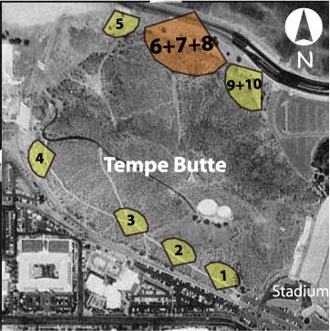
HELP with the Yellow Viewsheds: The yellow pie slices with numbers are the stops in your lab book. The orange color indicates your current stop. You go onto the next stop by clicking the stop you want in the navigation bar below, or by clicking on the next stop in the photo at the top.