|
Follow the Water Stop 5 of 13 |
|
|
NAVIGATION: Introduction > STOP # 1 2 3 4 5 6 7 8 9 10 11 12 13
| GPH 211 - GEOMORPHOLOGY |
| MODULE FIVE - FOLLOW THE WATER |
|
Follow the Water Stop 5 of 13 |
|
|
Follow the Water Stop 5 of 13 - Owens River from the Ground
|
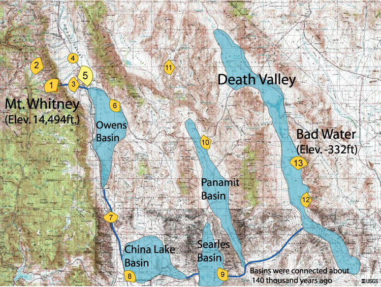
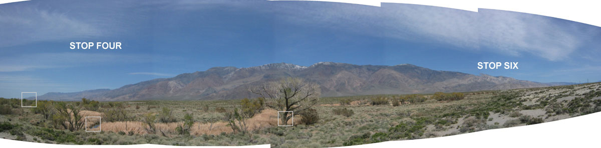
STOP 5: We are looking at the Owens River
in the
foreground with the White Mountains in the distant. The High
Sierra is behind us out of view. Water from Lone Pine Creek
drains into Owens River just downstream from this location. In
the past, water from Lone Pine Creek (and therefore Mt. Whitney) would
have drained into an Owens River that was busily filling Owens Basin to
the point of overflowing and what we look at next. But first,
let's take a look at Owens River. |