|
Follow the Water Stop 8 of 13 |
|
|
NAVIGATION: Introduction > STOP # 1 2 3 4 5 6 7 8 9 10 11 12 13
| GPH 211 - GEOMORPHOLOGY |
| MODULE FIVE - FOLLOW THE WATER |
|
Follow the Water Stop 8 of 13 |
|
|
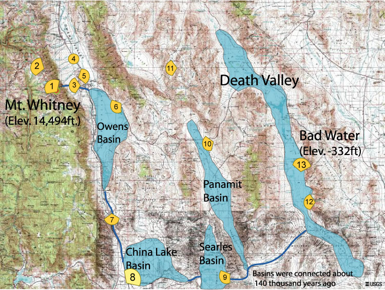
Follow the Water Stop 8 of 13 - China Lake Basin
| Stop
8: I tried to explain to them that we are following the water that once flowed from Mt. Whitney to Death Valley, but the guards just stared at me blankly... You are welcome to take a peak using http://mapper.acme.com/ and see why the area is closed off around these coordinates: N 35.75264 W 117.65259 . The depression of China Lake Basin is visible in the distance and as close as we are going to get. The Owens River flowed from Owens basin just below where it says "STOP SEVEN". Take a peek at the governmental facility (if you dare) and then head on to Stop 9. |
| Viewshed Map: |