|
Follow the Water Stop 7 of 13 |
|
|
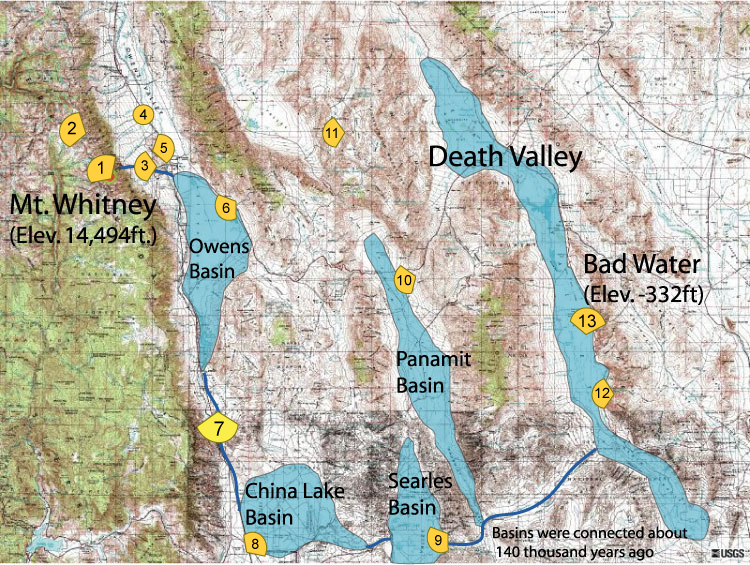
NAVIGATION: Introduction > STOP # 1 2 3 4 5 6 7 8 9 10 11 12 13
| GPH 211 - GEOMORPHOLOGY |
| MODULE FIVE - FOLLOW THE WATER |
|
Follow the Water Stop 7 of 13 |
|
|
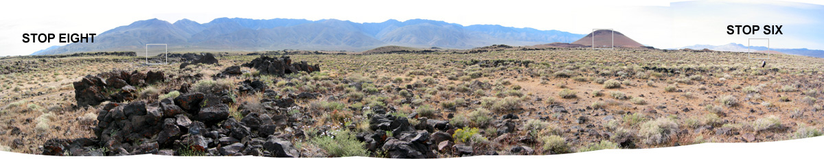
Follow the Water Stop 7 of 13 - Fossil Falls
| Stop
7: At this
stop, we are about 5 miles downstream of Owens Basin. The cinder cone in the middle right portion of the image and the basalt flow remnants (obvious in the foreground in the left part of the image) indicate recent volcanism. Interestingly enough, when water began to spill across from Owens Basins, it flowed across recent lava flows that blocked and dammed the flowing water's path. The ponded water would eventually overtop and breach the lava dam, sending an impressive flood downstream. For this stop, you get a closer look at the volcanism and flooding evidence. Viewshed Map: |